Technique and planning
skip List33 articles are displayed

European forest monitoring: improvements needed
Climate change requires further development of forest monitoring. The European Commission wants to help improve data quality to better understand future forest dynamics. Experts criticise the insufficient integration of existing monitoring networks.

Drones for the protection forest
Drone or unmanned aerial vehicles (UAVs) - who doesn't know them, these small remote-controlled flying machines with cameras? Especially as survey drones, however, they have a potential that goes far beyond taking nice photos from lofty heights. In the SANDRO project, these possibilities are to be developed specifically for the monitoring of protection forests.

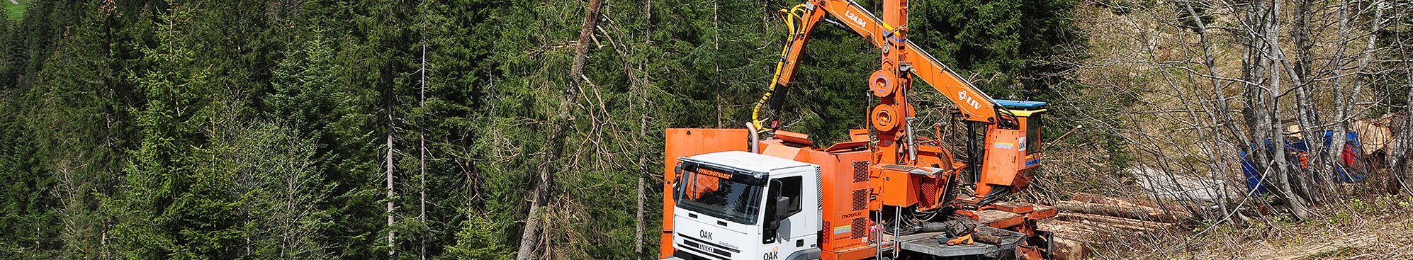
Use of harvester data in Bavaria
TUM project shows that continuous data exchange in the timber supply chain offers great potential - for everyone involved.

Using LiDAR to look for skid trails in the forest
To protect the forest floor and facilitate planning, the skid trail and extraction track network for timber harvesting in the canton of Aargau (Switzerland) is being digitised. The use of image recognition software and artificial intelligence has simplified and accelerated this process considerably.

Adapting timber harvesting methods to nature conservation requirements
The requirements of nature conservation in forests lead to greater structural richness. These forest structures make forest operations more difficult. This research project investigated how timber harvesting methods can be adapted to meet these challenges.

Estimation of the costs of tending young forest stands
The WSL research institute has developed the software JuWaPfl, which can estimate both the productivity and costs of important forestry measures undertaken at what is known as the first stage of production. An updated version is available since August 2024.

How to evaluate laser scanner data easily – with “3D Forest”
Terrestrial laser scanning is already a standard tool for describing forests in scientific studies. One constraint up to now has been the lack of software available to extract the forest measurement data. 3D Forest is a solution that now permits us to do this.

Do harvesters reduce the risk of bark beetles?
More and more of the processing of bark beetle-infested timber is being done by harvester: Does the force exerted by the harvester head reduce the suitability of the bark as a breeding site and destroy existing beetle broods? Ultimately it was unclear whether the logs required further processing after harvesting. Several studies on this have been carried out in the Black Forest.

Online tools for forests today and tomorrow
Two new, user-friendly online tools provide comprehensive information about forests and the services they provide, now and in the future.

On the way to branch free boles with a laser scanner
Terrestrial laser scanning - this technology can provide practice-relevant additional information in forest surveying when a full area is taken. This was tested in a chestnut observation area in Lower Franconia.

Over and above slopes and wetlands: extracting timber with a small cableway
Time to get the timber out of the forest! But how do we do it on slopes that are too steep, or where the ground is too wet? Is a small cableway possibly the solution?

Flooding, erosion and stagnant moisture
Heavy rains are weather extremes which are difficult to deal with. There are studies and measures to protect the forest and the population. This article describes the buffering effect of forests as well as the problematic conditions of flood protection.